Estate Maps, 1750s-1900s
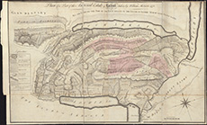
| Name: | Morison, William. |
| Title: | Plan of a part of the Annexed Estate of Lochiel / taken by William Morison 1772. |
| Imprint: | [S.l.], 1772. |
| Pagination: | 1 map ; 507 x 824 mm |
| Shelfmark: | EMS.s.289 |
| Zoom Into Map: | Click on the map to view in greater detail. |