Estate Maps, 1750s-1900s
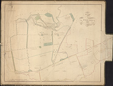
| Title: | Plan of Wood Hall [in Bothwell parish] 1809. |
| Imprint: | Drawn 1809. |
| Pagination: | 1 map ; 508 x 631 mm |
| Shelfmark: | Signet.s.070 |
| Notes: | We are very grateful to the WS Society for their permission to display this map online. View Signet Library collection maps of Scotland held at NLS. |
| Zoom Into Map: | Click on the map to view in greater detail. |