Estate Maps, 1750s-1900s
| Name: | Russell, R. |
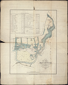
| Title: | Plan of the estate of Mauldslie in the county of Lanark, the property of Archibald Nisbet ... / surveyed by R. Russell ... (Lithographed by Forrester & Nichol). |
| Imprint: | [Edinburgh], 1835. |
| Pagination: | 1 map ; 422 x 305 mm |
| Shelfmark: | Signet.s.066 |
| Notes: | We are very grateful to the WS Society for their permission to display this map online. View Signet Library collection maps of Scotland held at NLS. |
| Zoom Into Map: | Click on the map to view in greater detail. |