Estate Maps, 1750s-1900s
| Name: | May, Peter (ca. 1724/35 - 1795) |
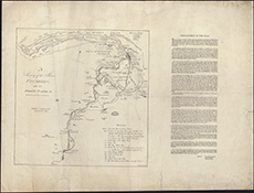
| Title: | A Survey of the River Findhorn with the fishing places, &c. / (W. Ballantine's lithog. Pet. May surveyor). |
| Imprint: | [S.l., ca. 1830] |
| Pagination: | 1 map ; 372 x 363 mm |
| Shelfmark: | Signet.s.055 |
| Notes: | We are very grateful to the WS Society for their permission to display this map online. View Signet Library collection maps of Scotland held at NLS. |
| Zoom Into Map: | Click on the map to view in greater detail. |