Town Plans / Views, 1580s-1940s
| Field | Content |
|---|---|
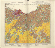
| Title: | Land utilisation survey of Britain. Sheet 74. Edinburgh [and environs] |
| Imprint: | London : Land Utilisation Survey of Britain, [1936] |
| Pagination: | 1 map : col. ; 61 x 71 cm |
| Shelfmark: | Signet.s.106 |
| Zoom Into Map: | Click on the map to view in greater detail. |
| Notes: | We are very grateful to the WS Society for their permission to display this map online. View Signet Library collection maps of Scotland held at NLS. |