County maps, 1580s-1950s
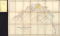
| Field | Content |
|---|---|
| Title: | Map shewing the burghs and four road districts in the county of Edinburgh, 1883. |
| Imprint: | Edinburgh : W. & A.K. Johnston, 1883. |
| Pagination: | 1 map : col. ; 63 x 92 cm, folded to 24 x 15 cm. |
| Shelfmark: | Map.m.343.38 |
| Zoom Into Map: | Click on the map to view in greater detail. |