Estate Maps, 1750s-1900s
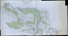

| Title: | Lovat Estate Woodlands |
| Imprint: | 1947 |
| Pagination: | 1 map: col.; 111 x 207 cm. |
| Shelfmark: | Lovat354-3 |
| Notes: | 1:5333. (5000' = 11.25" ). Three sketch maps rolled inside each other. These maps may have preceded the Dedicated Woodland Scheme. 2nd map - 0.45 x 1.55 3rd Map - . Courtesy of Lovat Highland Estates and the North of Scotland Archaeological Society. View Lovat Highland Estates mapping |
| Zoom Into Map: | Click on the map to view in greater detail. |