Estate Maps, 1750s-1900s
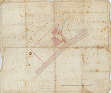

| Title: | [Hotel Site at Fort Augustus] |
| Imprint: | 19th century |
| Pagination: | 1 map: col.; 45 x 53 cm. |
| Shelfmark: | Lovat331 |
| Notes: | 1:359. (100' = 8.5 cm ). An undated map, shoing a building on the Invergarry-Fort Augustus road. Only the writing on the outside of the map - Hotel Site at FA - gives a clue as to its purpose.. Courtesy of Lovat Highland Estates and the North of Scotland Archaeological Society. View Lovat Highland Estates mapping |
| Zoom Into Map: | Click on the map to view in greater detail. |