Estate Maps, 1750s-1900s

| Name: | Ordnance Survey |
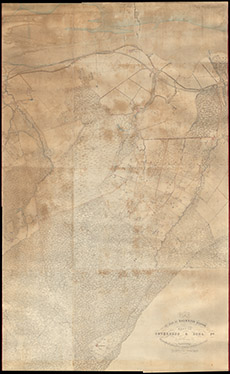
| Title: | Plan of Part of Kirkhill Parish next to Inverness & Bona Ph, distinguishing the Lans of Blairnahenachrie, Englishtown, Kirkton, Inchberry & Phopachy as Presently Possessed |
| Imprint: | 1872 |
| Pagination: | 1 map: col.; 233 x 143 cm. |
| Shelfmark: | Lovat322 |
| Notes: | 1:2500. (25.34 = 1 mile ). Courtesy of Lovat Highland Estates and the North of Scotland Archaeological Society. View Lovat Highland Estates mapping |
| Zoom Into Map: | Click on the map to view in greater detail. |