Estate Maps, 1750s-1900s

| Name: | Mitchell, Joseph (1803-1883) |
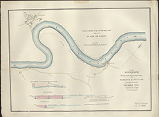
| Title: | Plan of Part of the River Beauly adjacent to the Town and Harbour |
| Imprint: | 1839 |
| Pagination: | 1 map: col.; 56 x 76 cm. |
| Shelfmark: | Lovat252 |
| Notes: | The map has an additional title: Plan Elevation & Secion for Altering, Extending and Improving the Harbour of Beauly at the Upper Extremity of the Murray Firth. There are three identical maps wrapped up inside each other Scale 1:960. (400' = 5" ). Courtesy of Lovat Highland Estates and the North of Scotland Archaeological Society. View Lovat Highland Estates mapping |
| Zoom Into Map: | Click on the map to view in greater detail. |