Estate Maps, 1750s-1900s
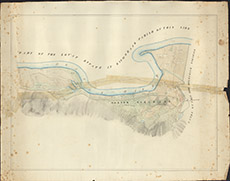

| Title: | [Wester Eskadale & Leimgorry (Old Plan)] |
| Imprint: | 1830s ? |
| Pagination: | 1 map: col.; 57 x 85 cm. |
| Shelfmark: | Lovat198 |
| Notes: | An undated map showing land allocation at Wester Eskadale Courtesy of Lovat Highland Estates and the North of Scotland Archaeological Society. View Lovat Highland Estates mapping |
| Zoom Into Map: | Click on the map to view in greater detail. |