Estate Maps, 1750s-1900s
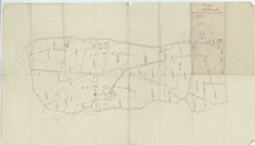

| Title: | [Sketch of Kinchoillie, Cruive and Knockvuy, 1873] |
| Imprint: | 1873 |
| Pagination: | 1 map; 58 x 53 cm. |
| Shelfmark: | Lovat195 |
| Notes: | A scanty sketch plan showing three farmsteads in kiltarlity parish Courtesy of Lovat Highland Estates and the North of Scotland Archaeological Society. View Lovat Highland Estates mapping |
| Zoom Into Map: | Click on the map to view in greater detail. |