Estate Maps, 1750s-1900s

| Name: | Ordnance Survey |
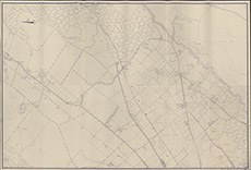
| Title: | [Culburnie, 25" to 1 mile] |
| Imprint: | 1940s ? |
| Pagination: | 1 map; 67 x 99 cm. |
| Shelfmark: | Lovat166 |
| Notes: | Looks like a special printing of an OS 25" map, showing Fanellan and parts of Culburnie. Maybe hand-drawn from OS map. Note N is to left edge of map Scale 1:2534. (25" = 1 mile ). Courtesy of Lovat Highland Estates and the North of Scotland Archaeological Society. View Lovat Highland Estates mapping |
| Zoom Into Map: | Click on the map to view in greater detail. |