Estate Maps, 1750s-1900s

| Title: | [Kirkhill] |
| Imprint: | 19th century |
| Pagination: | 1 manuscript map: col.; 53 x 42 cm. |
| Shelfmark: | Lovat064 |
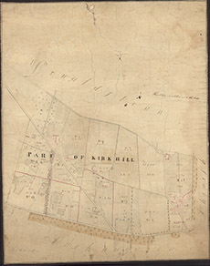
| Notes: | An unsigned map, showing allocation of lots in a part of Kirkhill, near Donaldston and Fingask. Scale 1:2376. (3 chains = 1" ). Courtesy of Lovat Highland Estates and the North of Scotland Archaeological Society. View Lovat Highland Estates mapping |
| Zoom Into Map: | Click on the map to view in greater detail. |