Estate Maps, 1750s-1900s

| Name: | Ordnance Survey |
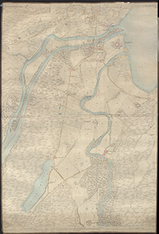
| Title: | [Fort Augustus] |
| Imprint: | 1876 |
| Pagination: | 1 map: col.; 134 x 92 cm. |
| Shelfmark: | Lovat014 |
| Notes: | A composite map formed from several sheets of 1st edition OS map, joined together, with some over-writing in pencil Scale 1:2534. (25" = 1 mile ). Courtesy of Lovat Highland Estates and the North of Scotland Archaeological Society. View Lovat Highland Estates mapping |
| Zoom Into Map: | Click on the map to view in greater detail. |