Estate Maps, 1750s-1900s
| Name: | Ordnance Survey |
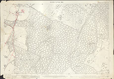
| Title: | [OS, SECOND EDITION, Inverness-shire, Sheet X.15] |
| Imprint: | ca. 1904 |
| Pagination: | 1 map: col.; 74 x 105 cm. |
| Shelfmark: | Belladrum10 |
| Notes: | Scale 1:2,500. (25" = 1 mile ). Courtesy of the North of Scotland Archaeological Society and Belladrum Estate. |
| Zoom Into Map: | Click on the map to view in greater detail. |