Estate Maps, 1750s-1900s

| Name: | Ker, Henry, fl. ca 1820-1832 |
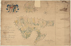
| Title: | A Plan of the Estate of Blacket in the Parish of Urr |
| Imprint: | 1818 |
| Pagination: | 1 manuscript map: col.; 66 x 100 cm. |
| Shelfmark: | GGD436/17 |
| Notes: | Courtesy of the Ewart Library through the Dumfries Archival Mapping Project. |
| Zoom Into Map: | Click on the map to view in greater detail. |