Estate Maps, 1750s-1900s

| Name: | Newall, Walter, 1780-1863 |
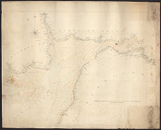
| Title: | Untitled [Map of the Solway Firth from Carlisle to Maryport and Airds Point, Kirkcudbrightshire, copied from Robinson'd Admiralty Chart of the Solway Firth, 1837, but extended north to Dumfries] |
| Imprint: | post-1839 |
| Pagination: | 1 manuscript map: col.; 67 x 84 cm. |
| Shelfmark: | GGD131/F5/11 |
| Notes: | Courtesy of the Ewart Library through the Dumfries Archival Mapping Project. |
| Zoom Into Map: | Click on the map to view in greater detail. |