Estate Maps, 1750s-1900s

| Name: | Burn, Robert, 1752-1815 |
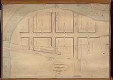
| Title: | Building Ground of Sir George Clark, Messrs Thrashie, Laidlaw & Ker, Dumfries |
| Imprint: | 1806 |
| Pagination: | 1 manuscript map : col.; 49 x 71 cm. |
| Shelfmark: | Map/B/4/9 |
| Notes: | Courtesy of Dumfries Museum through the Dumfries Archival Mapping Project - view futher details. |
| Zoom Into Map: | Click on the map to view in greater detail. |