Town Plans / Views, 1580s-1940s
| Field | Content |
|---|---|
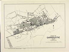
| Name: | Anderson, A. F. (Burgh Surveyor) |
| Title: | Plan of Carnoustie, 1927. |
| Imprint: | [Dundee : James P. Mathew & Co., 1927] |
| Pagination: | 1 map; 258 x 349 mm. |
| Shelfmark: | Y.54 |
| Zoom Into Map: | Click on the map to view in greater detail. |