Maps of Jamaica by James Robertson, 1804
| Name: | Robertson, James, ca. 1756-1829 |
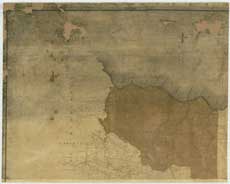
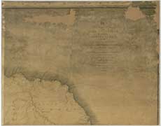
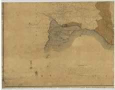
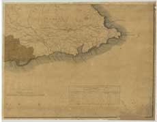
| Title: | To His Royal Highness the Duke of Clarence, this map of the county of Surrey, in the island of Jamaica, constructed from actual surveys... |
| Imprint: | London : J. Robertson, 1804. |
| Pagination: | 1 map on 4 sheets : col. ; 130 x 166 cm., sheets 65 x 83 cm. |
| Shelfmark: | EMAM.s.5 |
| Zoom Into Map: | Click on the maps below to order image or view in greater detail. |
| Notes: | View georeferenced map |
 |
 |
 |
 |
About this site
Quick search and browse
Practical information
Collaborative projects
© 2024 National Library of Scotland, registered Scottish Charity, No. SC011086