Maps of Scotland
| Field | Content |
|---|---|
| Name: | Pont, Timothy, 1560?-1614? |
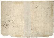
| Title: | [Ben Hee to Faraid head, Northwest Sutherland] - Pont 3 (back) |
| Imprint: | [ca. 1583-96] |
| Pagination: | 1 manuscript map ; 41 x 28 cm. |
| Shelfmark: | Adv.MS.70.2.9 (Pont 3v) |
| Notes: | This is the back of the manuscript called Pont 3. It contains one small rudimentary map known as Pont 3(3). (Two other maps, Pont 3(1) and Pont 3(2), occur on the other side of the sheet.) The map shown here is in fact a continuation of the large Eddrachillis map (Pont 3(1)) on the front (recto) of this sheet, as well as Pont 1 and 2 of Durness and Strathnaver. It shows the area from Ben Hee and Glen Golly in the south towards Durness and Faraid Head in the north.
View the Pont Maps website. View maps by Blaeu and Robert and James Gordon. |
| Zoom Into Map: | Click on the map to view in greater detail. |