County maps, 1580s-1950s
| Field | Content |
|---|---|
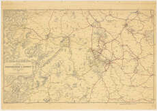
| Name: | London. Railway Clearing House. |
| Title: | Official railway map of Staffordshire & district / prepared and published at the Railway Clearing House, London ... (Drawn and engraved by J. & W. Emslie). |
| Imprint: | London, 1930. |
| Pagination: | 1 map ; 645 x 1030 mm. |
| Shelfmark: | Map.l.84.25 |
| Notes: | Scale ca. 1:126,720 |
| Zoom Into Map: | Click on the map to view in greater detail. |