County maps, 1580s-1950s
| Field | Content |
|---|---|
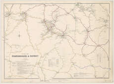
| Name: | Airey, John. |
| Title: | Railway map of Staffordshire & District ... / by John Airey ... (J. Emstie & Sons, engravers & lithos.). |
| Imprint: | London : J. Airey, [1874] |
| Pagination: | 1 map ; 510 x 709 mm. |
| Shelfmark: | Map.l.26.16 |
| Notes: | Scale 1:126,720 |
| Zoom Into Map: | Click on the map to view in greater detail. |