County maps, 1580s-1950s
| Field | Content |
|---|---|
| Name: | Evans, Prebendary. |
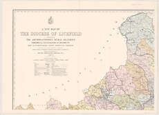
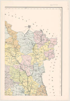
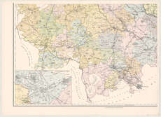
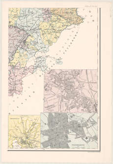
| Title: | A new map of the diocese of Lichfield shewing the archdeaconries, rural deanries parishes & ecclesiastical districts and distinguishing every benefice therein constructed ... / under the superintendence of ... Prebendary Evans. |
| Imprint: | London : E. Stanford, 1873. |
| Pagination: | 1 map on 4 sheets. |
| Shelfmark: | Map.l.23.27 |
| Notes: | Scale 1:126,720 Insets: Shrewsbury; Derby; Wolverhampton; [and] Staffordshire Potteries. |
| Zoom Into Map: | Click on the maps below to order image or view in greater detail. |