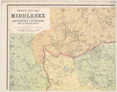
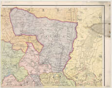
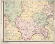
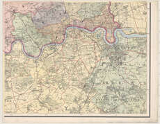
County maps, 1580s-1950s
| Field | Content |
|---|---|
| Name: | Bartholomew, John, 1831-1893. |
| Title: | Philip's new map of Middlesex with portions of the adjoining counties from the Ordnance Survey / by J. Bartholomew. |
| Imprint: | London, [1881] |
| Pagination: | 1 map on 4 sheets. |
| Shelfmark: | Map.l.26.13 |
| Notes: | Scale 1:30,171 |
| Zoom Into Map: | Click on the maps below to order image or view in greater detail. |
 |
 |
 |
 |