County maps, 1580s-1950s
| Field | Content |
|---|---|
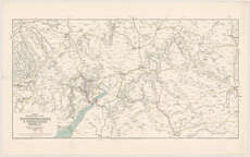
| Name: | J. & W. Emslie. |
| Title: | Official railway map of the Gloucestershire & Oxfordshire districts. Prepared and published at the Railway Clearing House, London / drawn and engraved by J. & W. Emslie. |
| Imprint: | London, 1911. |
| Shelfmark: | Map.l.12.31 |
| Notes: | Scale 1" = 2 1/3 miles approx. |
| Zoom Into Map: | Click on the map to view in greater detail. |