County maps, 1580s-1950s
| Field | Content |
|---|---|
| Name: | Swire, William. Hutchings, W. F |
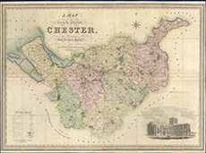
| Title: | A map of the county palatine of Chester, divided into hundreds & parishes, from an accurate survey, made in the years 1828 and 1829 |
| Imprint: | London : H. Teesdale & Co., 1830 |
| Pagination: | 1 map ; 877 x 1227 mm. |
| Shelfmark: | EME.b.3.17 |
| Notes: | Scale: 1 1/3 miles to an inch |
| Zoom Into Map: | Click on the map to view in greater detail. |