County maps, 1580s-1950s
| Field | Content |
|---|---|
| Name: | Jefferys, Thomas, -1771 |
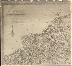
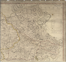
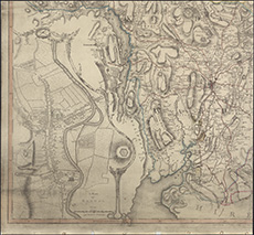
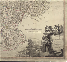
| Title: | The county of Westmoreland |
| Imprint: | London : T. Jefferys, 1770 |
| Pagination: | 1 map on 4 sheets ; sheets ca. 52 x 56 cm (ca. 20 x 22 inches) |
| Notes: | Surveyed: 1778. Scale: 1 inch to a mile. |
| Notes: | Scale: 1 inch to a mile. |
| Shelfmark: | EME.s.47 |
| Zoom Into Map: | Click on the maps below to order image or view in greater detail. |