County maps, 1580s-1950s
| Field | Content |
|---|---|
| Name: | Greenwood, C. (Christopher), 1786-1855 Greenwood, John (fl.1821–1840) |
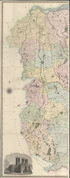
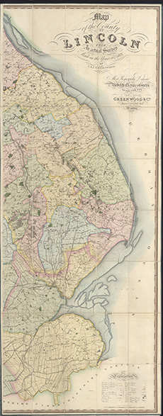
| Title: | Map of the County of Lincoln from an actual survey made in the years 1827 & 1828 |
| Imprint: | London : Greenwood & Co., 1830 |
| Pagination: | 1 map on 2 sheets ; sheets ca. 205 x 81 cm (ca. 81 x 32 inches). |
| Notes: | Scale: 1 inch to a mile. View georeferenced map. |
| Shelfmark: | EME.b.3.60 |
| Zoom Into Map: | Click on the maps below to order image or view in greater detail. |
 |
 |