Ordnance Survey - Quarter Inch to the Mile Maps of England, Scotland and Wales
3rd edition (Outline), 1921-1930
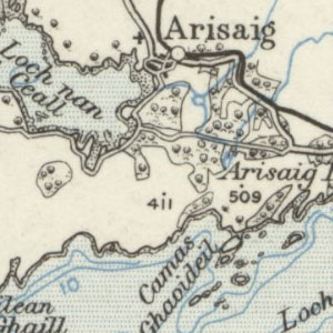
These maps at quarter inch to the mile (1:253,440) were reduced from larger-scale mapping at the half-inch and one-inch to the mile scales, primarily dating from the third national revision of 1912-1923. With some minor variations, each sheet covers 72 x 108 miles, with all of England and Wales covered in 12 sheets, and all of Scotland covered in ten sheets. This outline or uncoloured series had all topography and text printed in black, with water in blue. The quarter-inch to the mile series provides an overview of significant landscape features, including larger settlements, railways, and roads. These maps are held at Map.Area.C18(63) for Scotland, and Map.Area.C17(64A) for England and Wales .
View other quarter-inch to the mile maps of Scotland or England and Wales.
- View the maps with a graphic index
View sheets covering England and Wales and Scotland.
England and Wales - Outline edition with water in blue
| Sheet | Revision details | Date of Publication |
|---|---|---|
| Sheet 2 - England, North West | 1923 | |
| Sheet 3 - England, North East | 1923 | |
| Sheet 4 - North Wales | 1923 | |
| Sheet 5 - Midlands (N.) | 1923 | |
| Sheet 6 - Eastern Counties (N.) | 1923 | |
| Sheet 7 - South Wales | 1923 | |
| Sheet 8 - Midlands (S.) | 1923 | |
| Sheet 9 - Eastern Counties (S.) | 1923 | |
| Sheet 10 - England, South West | 1923 | |
| Sheet 11 - England, South | 1923 | |
| Sheet 12 - England, South East & London | Railways: 1922 | 1923 |
England and Wales - New Series
| Sheet | Revision details | Date of Printing |
|---|---|---|
| Sheet 2A - North Central | ca. 1926 | |
| Sheet 4A - North Wales & Manchester | Railways inserted to 1927. Minor Corrections: 1923 to 1928 | 1928 |
| Sheet 7A - South Wales | Minor Corrections: 1928 | 1929 |
| Sheet 8A - Midlands | Roads revised 1925 to 1928. Minor Corrections: 1929 | 1929 |
| Sheet 9A - East Anglia | Roads revised 1925 to 1928. Minor Corrections: 1929 | 1930 |
Scotland
| Sheet Number and Name | Publication Date |
|---|---|
| Sheet 1 - The Border | 1923 |
| Sheet 2 - Scotland, South West | 1924 |
| Sheet 3 - The Forth & Tay | 1924 |
| Sheet 4 - Glasgow, Oban, and the Southern Islands | 1923 |
| Sheet 4 - Glasgow, Oban, and the Southern Islands | 1924 |
| Sheet 5 - The Eastern Highlands | 1924 |
| Sheet 6 - The Western Highlands (with Skye and the Southern Hebrides) | 1922 |
| Sheet 7 - Scotland, North | 1924 |
| Sheet 8 - The Northern Hebrides | 1924 |
| Sheet 9 - The Orkney Islands | 1924 |
| Sheet 10 - The Shetland Islands | 1924 |