Ordnance Survey - Quarter Inch to the Mile Maps of England, Scotland and Wales
2nd edition (Outline), 1908-1915
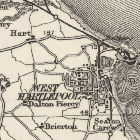
These maps at quarter-inch to the mile (1:253,440) are the second edition of these uncoloured sheets by Ordnance Survey at this scale. Detail was drawn from larger-scale maps, comprehensively revised in the 1890s. The quarter-inch to the mile series provides an overview of significant landscape features, including larger settlements, railways, and roads. We only have 16 sheets out of 23 covering England and Wales, but only two sheets of this series, which covers Scotland in 17 sheets, numbered from north to south. These are held at Map.Area.C18(61A) for Scotland and Map.Area.C17(62) (standard series) and Map.Area.C17(63) (Large-sheet series) for England and Wales .
View other quarter-inch to the mile maps of Scotland or England and Wales.
- View the maps with a graphic index.
View sheets covering:
- England and Wales - standard series
- England and Wales - Large Sheet series - Black Outline Edition
- Scotland.
England and Wales - standard series
| Sheet | Date of Publication |
|---|---|
| Sheets 1 & 2 | 1908 |
| Sheet 3 | 1909 |
| Sheet 4 | 1909 |
| Sheet 8 | 1909 |
| Sheets 9 & 10 | 1910 |
| Sheet 11 | 1911 |
| Sheet 12 | 1912 |
| Sheet 13 | 1912 |
| Sheet 14 | 1913 |
| Sheet 15 | 1912 |
| Sheet 16 | 1911 |
| Sheet 18 | 1911 |
| Sheet 19 & 23 | 1910 |
| Sheets 20 & 24 | 1909 |
| Sheets 21 & 25 | 1911 |
| Sheet 22 | 1913 |
England and Wales - Large Sheet series - Black Outline Edition
| Sheet | Revision details | Date of Printing |
|---|---|---|
| Sheet 1 | ca. 1915 | |
| Sheet 2 | 1914 | |
| Sheet 3 | 1914 | |
| Sheet 4 | Railways: 1913. Minor Corrections: 1913 | 1913 |
| Sheet 5 | 1913 | |
| Sheet 6 | 1913 | |
| Sheet 7 | 1913 | |
| Sheet 8 | 1913 | |
| Sheet 9 | 1913 | |
| Sheet 10 | 1912 |
Scotland
| Sheet Number and Name | Revision details | Date of Revision | Date of Publication |
|---|---|---|---|
| Sheet 13 | Second edition | No date on sheets | 1909 |
| Sheet 14 | Second edition. Printed at the Ordnance Survey Office 1914 | No date on sheets | 1914 |