Ordnance Survey - Quarter Inch to the Mile Maps of England, Scotland and Wales
1st edition (Outline), 1899-1906
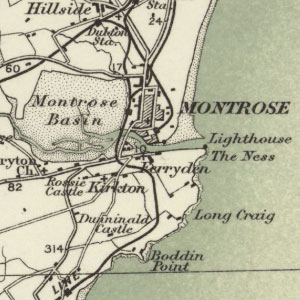
These maps at quarter-inch to the mile (1:253,440) were the earliest, uncoloured sheets by Ordnance Survey at this scale which formed a complete series, covering all of Scotland in 17 sheets. Detail was drawn from larger-scale maps, comprehensively revised in the 1890s. The quarter-inch to the mile series provides an overview of significant landscape features, including larger settlements, railways, and roads. These maps are held at: Map.Area.C18(61) (Scotland) and Map.Area.C17(61A) (England and Wales) .
View other quarter-inch to the mile maps of Scotland or England and Wales.
- View the maps with a graphic index.
- View the maps as a seamless layer on a satellite image base
View sheets covering England and Wales and Scotland.
England and Wales
| Sheet | Date of revision | Date of Publication |
|---|---|---|
| Sheets 1 & 2 | 1894 to 1895 | 1899 |
| Sheet 3 | 1895 to 1896 | 1899 |
| Sheets 4 | 1894 to 1897 | 1900 |
| Sheets 5 & 6 | 1895 to 1896 | 1900 |
| Sheet 7 | 1893 to 1897 | 1901 |
| Sheet 8 | 1893 to 1897 | 1900 |
| Sheets 9 & 10 | 1895 to 1898 | 1900 |
| Sheet 11 | 1894 to 1898 | 1901 |
| Sheet 12 | 1897 to 1898 | 1901 |
| Sheet 13 | 1897 | 1899 |
| Sheet 14 | 1893 to 1898 | 1901 |
| Sheet 15 | 1893 to 1898 | 1901 |
| Sheet 16 | 1893 to 1897 | 1900 |
| Sheet 17 | 1894 to 1897 | 1899 |
| Sheet 18 | 1893 to 1898 | ca. 1899 |
| Sheet 19 | 1893 to 1897 | 1900 |
| Sheets 20 & 24 | 1887 to 1894 | 1899 |
| Sheets 21 & 25 | 1893 to 1896 | 1899 |
| Sheet 22 | 1894 to 1897 | 1899 |
| Sheet 23 | 1893 to 1896 | 1899 |
Scotland
| Sheet Number and Name | Revision details | Date of Revision | Date of Publication |
|---|---|---|---|
| Sheet 1 | 1895 | 1901 | |
| Sheet 2 | 1895 | 1901 | |
| Sheet 3 | 1895 | 1901 | |
| Sheet 4 | 1894 to 1895 | 1901 | |
| Sheet 5 | 1894 | 1901 | |
| Sheet 6 | 1894 | 1901 | |
| Sheet 7 | 1894 to 1895 | 1902 | |
| Sheet 8 | Railways inserted to 1901 | 1894 | 1902 |
| Sheet 9 | Railways revised to April 1911 | 1894 | 1902 |
| Sheet 9 | Railways inserted to 1902 | 1894 | 1902 |
| Sheet 10 | Railway shown but insertion not mentioned | 1895 to 1896 | 1902 |
| Sheet 10 | Railways inserted to April 1911 | 1895 to 1896 | 1902 |
| Sheet 11 | 1894 to 1895 | 1902 | |
| Sheet 12 | 1894 to 1895 | 1902 | |
| Sheet 13 | 1895 | 1902 | |
| Sheet 14 | 1894 to 1895 | 1902 | |
| Sheet 15 (England Part of Sheet 2) | Includes part of England sheet 2. Railways inserted to Sept. 1905 (Scotland) | 1894 to 1895 | 1902 |
| Sheet 15 (England Part of Sheet 2) | Includes part of England sheet 2. Railways inserted to June 1900 (England) | 1894 to 1895 | 1902 |
| Sheet 16 | Printed from a transfer to zinc in 1901 | 1895 | 1901 |
| Sheet 17 | Includes parts of England sheets 1,2,3,4. Boundary of Durfriesshire revised 1898. Printed from a transfer to zinc in 1901 | 1895 | 1901 |