Ordnance Survey Maps of Great Britain
| Field | Content |
|---|---|
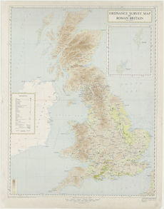
| Name: | Great Britain. Ordnance Survey. |
| Title: | Ordnance Survey map of Roman Britain. |
| Imprint: | Chessington : Ordnance Survey, 1956 |
| Pagination: | 1 map: col.; 98 x 76 cm, on sheet 85 x 109 cm. |
| Shelfmark: | Map.Area.C16(203) |
| Zoom Into Map: | Click on the map to view in greater detail. |