Mapmakers
Your search for Wilson, T returned 9 records.
Ordered chronologically (undated items first).
| Field | Content | |
|---|---|---|
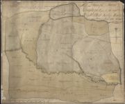
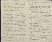
| Name: | Wilson, Thomas | |
| Title: | A Plan of the Farm of Longhope the property of the Right Honble. Sr. Gilbt. Elliot Bart. of Minto: 1767. | |
| Imprint: | 1767 | |
| Zoom Into Map: | Click on the map to view in greater detail. | |
| Field | Content | |
|---|---|---|
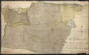
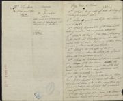
| Name: | Wilson, Thomas | |
| Title: | A Plan of the Farm of Shiels-Wood the property of the Right Honble. Sr. Gilbert Elliot Btr. Of Minto: 1767 | |
| Imprint: | 1767 | |
| Zoom Into Map: | Click on the map to view in greater detail. | |
| Field | Content | |
|---|---|---|
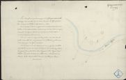
| Name: | Wilson, Thomas | |
| Title: | Plan of Minto Burn, showing planned excambion between Sir Gilbert Elliot and the Duke of Roxburghe, by Thomas Wilson, 1768. | |
| Imprint: | 1768 | |
| Zoom Into Map: | Click on the map to view in greater detail. | |
| Field | Content | |
|---|---|---|
| Name: | Wilson, Thomas | |
| Title: | Plan of Minto Burn, showing planned excambion between Sir Gilbert Elliot and the Duke of Buccleuch, by Thomas Wilson, 1769. | |
| Imprint: | 1769 | |
| Zoom Into Map: | Click on the map to view in greater detail. | |
| Field | Content | |
|---|---|---|
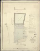
| Name: | Wilson, Thomas | |
| Title: | Glasgow - Plan of reservoir near Drygate St. for Cranstonhill Water Co. | |
| Imprint: | 1828 | |
| Zoom Into Map: | Click on the map to view in greater detail. | |
| Field | Content | |
|---|---|---|
| Name: | Wilson, Thomas | |
| Title: | Glasgow - Plan of reservoir near Drygate St. for Cranstonhill Water Co. | |
| Imprint: | 1828 | |
| Zoom Into Map: | Click on the map to view in greater detail. | |
| Field | Content | |
|---|---|---|
| Name: | Wilson, Thomas | |
| Title: | Glasgow - Plan of reservoir near Drygate St. for Cranstonhill Water Co. | |
| Imprint: | 1828 | |
| Zoom Into Map: | Click on the map to view in greater detail. | |
| Field | Content | |
|---|---|---|
| Name: | Wilson, Thomas | |
| Title: | Glasgow - Plan of reservoir near Drygate St. for Cranstonhill Water Co. | |
| Imprint: | 1828 | |
| Zoom Into Map: | Click on the map to view in greater detail. | |
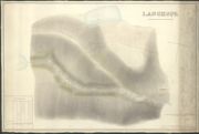
| Field | Content | |
|---|---|---|
| Name: | Blackadder, John (fl. 1793-1830) Wilson, Thomas | |
| Title: | Langhope…by John Blackadder, 1830, after an original plan measured by Thomas Wilson, 1767 | |
| Imprint: | 1830 (1767) | |
| Zoom Into Map: | Click on the map to view in greater detail. | |