Mapmakers
Your search for Ainslie, John returned 78 records.
Ordered chronologically (undated items first).
| Field | Content | |
|---|---|---|
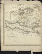
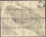
| Name: | Ainslie, John, 1745-1828 | |
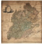
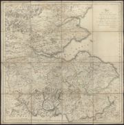
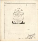
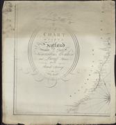
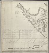
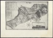
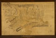
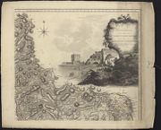
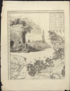
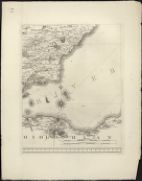
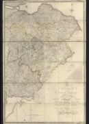
| Title: | Map of Selkirkshire or Ettrick Forest. | |
| Imprint: | S.l. : s.n., 1773. | |
| Zoom Into Map: | Click on the map to view in greater detail. | |
| Field | Content | |
|---|---|---|
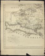
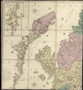
| Name: | Ainslie, John, 1745-1828 | |
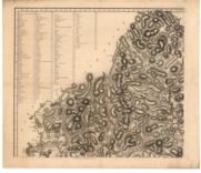
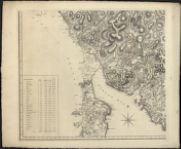
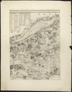
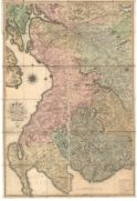
| Title: | Counties of Fife and Kinross with the Rivers Forth and Tay | |
| Subtitle: | North-west sheet | |
| Imprint: | London : s.n., 1775. | |
| Zoom Into Map: | Click on the map to view in greater detail. | |
| Field | Content | |
|---|---|---|
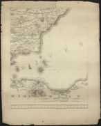
| Name: | Ainslie, John, 1745-1828 | |
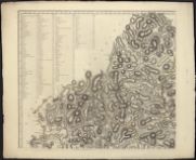
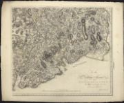
| Title: | [North west] The Counties of Fife and Kinross with the rivers Forth and Tay / survey'd & engraved by John Ainslie. | |
| Imprint: | London, 1775. | |
| Zoom Into Map: | Click on the map to view in greater detail. | |
| Field | Content | |
|---|---|---|
| Name: | Ainslie, John, 1745-1828 | |
| Title: | [North east] The Counties of Fife and Kinross with the rivers Forth and Tay / survey'd & engraved by John Ainslie. | |
| Imprint: | London, 1775. | |
| Zoom Into Map: | Click on the map to view in greater detail. | |
| Field | Content | |
|---|---|---|
| Name: | Ainslie, John, 1745-1828 | |
| Title: | [South west] The Counties of Fife and Kinross with the rivers Forth and Tay / survey'd & engraved by John Ainslie. | |
| Imprint: | London, 1775. | |
| Zoom Into Map: | Click on the map to view in greater detail. | |
| Field | Content | |
|---|---|---|
| Name: | Ainslie, John, 1745-1828 | |
| Title: | [South west duplicate] The Counties of Fife and Kinross with the rivers Forth and Tay / survey'd & engraved by John Ainslie. | |
| Imprint: | London, 1775. | |
| Zoom Into Map: | Click on the map to view in greater detail. | |
| Field | Content | |
|---|---|---|
| Name: | Ainslie, John, 1745-1828 | |
| Title: | [South centre] The Counties of Fife and Kinross with the rivers Forth and Tay / survey'd & engraved by John Ainslie. | |
| Imprint: | London, 1775. | |
| Zoom Into Map: | Click on the map to view in greater detail. | |
| Field | Content | |
|---|---|---|
| Name: | Ainslie, John, 1745-1828 | |
| Title: | [South east] The Counties of Fife and Kinross with the rivers Forth and Tay / survey'd & engraved by John Ainslie. | |
| Imprint: | London, 1775. | |
| Zoom Into Map: | Click on the map to view in greater detail. | |
| Field | Content | |
|---|---|---|
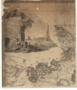
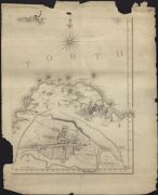
| Name: | Ainslie, John, 1745-1828 | |
| Title: | To the right honourable James Stewart Mackenzie, Lord Privy Seal of Scotland ... this map of the environs of Edinburgh is ... / inscribed by ... John Ainslie. | |
| Imprint: | Edinburgh, 1778. | |
| Zoom Into Map: | Click on the map to view in greater detail. | |
| Field | Content | |
|---|---|---|
| Name: | Ainslie, John, 1745-1828 ? | |
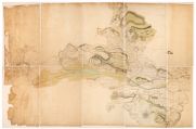
| Title: | [Castle Semple Estate plan, Lochwinnoch, Renfrewshire] | |
| Imprint: | ca. 1782 | |
| Zoom Into Map: | Click on the map to view in greater detail. | |
| Field | Content | |
|---|---|---|
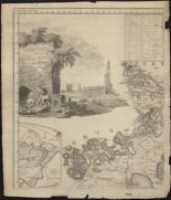
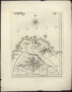
| Name: | Ainslie, John, 1745-1828 | |
| Title: | Jedburgh and its environs. | |
| Subtitle: | North west sheet | |
| Imprint: | [Edinburgh? : Ainslie?, 1780] | |
| Zoom Into Map: | Click on the map to view in greater detail. | |
| Field | Content | |
|---|---|---|
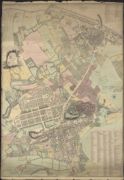
| Name: | Ainslie, John, 1745-1828 | |
| Title: | City of Edinburgh. | |
| Imprint: | Edinburgh : [Ainslie?, 1780]. | |
| Zoom Into Map: | Click on the map to view in greater detail. | |
| Field | Content | |
|---|---|---|
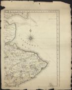
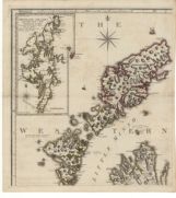
| Name: | Ainslie, John, 1745-1828 | |
| Title: | A map of the county of Wigton. | |
| Imprint: | Edinburgh : Ainslie, 1782. | |
| Zoom Into Map: | Click on the map to view in greater detail. | |
| Field | Content | |
|---|---|---|
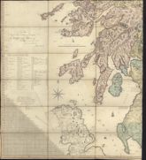
| Name: | Ainslie, John, 1745-1828 | |
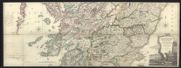
| Title: | Ainslie's travelling map of Scotland shewing the distances from one stage to another. | |
| Imprint: | Edinburgh : J. Ainslie, 1783. | |
| Zoom Into Map: | Click on the map to view in greater detail. | |
| Field | Content | |
|---|---|---|
| Name: | Ainslie, John, 1745-1828 | |
| Title: | Ainslie's travelling map of Scotland shewing the distances from one stage to another. | |
| Imprint: | Edinburgh : JAinslie, 1783. | |
| Zoom Into Map: | Click on the map to view in greater detail. | |
| Field | Content | |
|---|---|---|
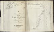
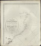
| Name: | Ainslie, John, 1745-1828 | |
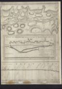
| Title: | A chart of part of the North of Scotland, from Banff to Duncansby Head. | |
| Subtitle: | North-west sheet | |
| Imprint: | [Edinburgh : J. Ainslie, 1785] | |
| Zoom Into Map: | Click on the map to view in greater detail. | |
| Field | Content | |
|---|---|---|
| Name: | Ainslie, John, 1745-1828 | |
| Title: | A chart of part of the South of Scotland, from Berwick upon Tweed to Skateraw Harbour in the County of Kincardine… | |
| Subtitle: | North-west sheet | |
| Imprint: | [Edinburgh : J. Ainslie, 1785] | |
| Zoom Into Map: | Click on the map to view in greater detail. | |
| Field | Content | |
|---|---|---|
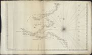
| Name: | Ainslie, John, 1745-1828 | |
| Title: | A general chart of the coast of Scotland from Berwick upon Tweed to Duncansbyhead in Caithness / Surveyd [sic] and engraved by John Ainslie. | |
| Subtitle: | Central sheet | |
| Imprint: | [Edinburgh: J Ainslie 1785] | |
| Zoom Into Map: | Click on the map to view in greater detail. | |
| Field | Content | |
|---|---|---|
| Name: | Ainslie, John, 1745-1828 | |
| Title: | A general chart of the coast of Scotland from Berwick upon Tweed to Duncansbyhead in Caithness / Surveyd [sic] and engraved by John Ainslie. | |
| Subtitle: | North sheet | |
| Imprint: | [Edinburgh: J Ainslie 1785] | |
| Zoom Into Map: | Click on the map to view in greater detail. | |
| Field | Content | |
|---|---|---|
| Name: | Ainslie, John, 1745-1828 | |
| Title: | A general chart of the coast of Scotland from Berwick upon Tweed to Duncansbyhead in Caithness / Surveyd [sic] and engraved by John Ainslie. | |
| Subtitle: | South sheet | |
| Imprint: | [Edinburgh: J Ainslie 1785] | |
| Zoom Into Map: | Click on the map to view in greater detail. | |
| Field | Content | |
|---|---|---|
| Name: | Ainslie, John, 1745-1828 | |
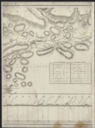
| Title: | A chart of part of Scotland containing the coasts of Kincardine Aberdeen and Banff Shires / from an actual survey by John Ainslie in 1784 and 1785. | |
| Subtitle: | South West sheet | |
| Imprint: | [Edinburgh: J Ainslie 1785] | |
| Zoom Into Map: | Click on the map to view in greater detail. | |
| Field | Content | |
|---|---|---|
| Name: | Ainslie, John, 1745-1828 | |
| Title: | A chart of part of Scotland containing the coasts of Kincardine Aberdeen and Banff Shires / from an actual survey by John Ainslie in 1784 and 1785. | |
| Subtitle: | South East sheet | |
| Imprint: | [Edinburgh: J Ainslie 1785] | |
| Zoom Into Map: | Click on the map to view in greater detail. | |
| Field | Content | |
|---|---|---|
| Name: | Ainslie, John, 1745-1828 | |
| Title: | A chart of part of Scotland containing the coasts of Kincardine Aberdeen and Banff Shires / from an actual survey by John Ainslie in 1784 and 1785. | |
| Subtitle: | North East sheet | |
| Imprint: | [Edinburgh: J Ainslie 1785] | |
| Zoom Into Map: | Click on the map to view in greater detail. | |
| Field | Content | |
|---|---|---|
| Name: | Ainslie, John, 1745-1828 | |
| Title: | A chart of part of Scotland containing the coasts of Kincardine Aberdeen and Banff Shires / from an actual survey by John Ainslie in 1784 and 1785. | |
| Subtitle: | North West sheet | |
| Imprint: | [Edinburgh: J Ainslie 1785] | |
| Zoom Into Map: | Click on the map to view in greater detail. | |
| Field | Content | |
|---|---|---|
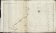
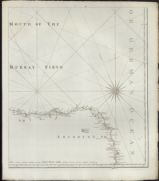
| Name: | Ainslie, John, 1745-1828 | |
| Title: | A Chart of part of the coast of Scotland from Peterhead in Aberdeenshire to Findhorn in Elginshire shewing the opposite coast from Helmsdale to Duncansby Head in Caithness / from an actual survey by John Ainslie. | |
| Subtitle: | North West sheet | |
| Imprint: | [Edinburgh: J Ainslie 1785] | |
| Zoom Into Map: | Click on the map to view in greater detail. | |
| Field | Content | |
|---|---|---|
| Name: | Ainslie, John, 1745-1828 | |
| Title: | A Chart of part of the coast of Scotland from Peterhead in Aberdeenshire to Findhorn in Elginshire shewing the opposite coast from Helmsdale to Duncansby Head in Caithness / from an actual survey by John Ainslie. | |
| Subtitle: | North East sheet | |
| Imprint: | [Edinburgh: J Ainslie 1785] | |
| Zoom Into Map: | Click on the map to view in greater detail. | |
| Field | Content | |
|---|---|---|
| Name: | Ainslie, John, 1745-1828 | |
| Title: | A Chart of part of the coast of Scotland from Peterhead in Aberdeenshire to Findhorn in Elginshire shewing the opposite coast from Helmsdale to Duncansby Head in Caithness / from an actual survey by John Ainslie. | |
| Subtitle: | South West sheet | |
| Imprint: | [Edinburgh: J Ainslie 1785] | |
| Zoom Into Map: | Click on the map to view in greater detail. | |
| Field | Content | |
|---|---|---|
| Name: | Ainslie, John, 1745-1828 | |
| Title: | A Chart of part of the coast of Scotland from Peterhead in Aberdeenshire to Findhorn in Elginshire shewing the opposite coast from Helmsdale to Duncansby Head in Caithness / from an actual survey by John Ainslie. | |
| Subtitle: | South East sheet | |
| Imprint: | [Edinburgh: J Ainslie 1785] | |
| Zoom Into Map: | Click on the map to view in greater detail. | |
| Field | Content | |
|---|---|---|
| Name: | Whitworth, Robert, 1734-1799 Laurie, John, fl. 1757-1800 Ainslie, John, 1745-1828 | |
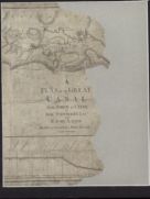
| Title: | A plan of the Great Canal from Forth to Clyde / by Robt. Whitworth... and... John Laurie. Drawn and engraved by John A inslie... | |
| Imprint: | [Glasgow], 1785. | |
| Zoom Into Map: | Click on the map to view in greater detail. | |
| Field | Content | |
|---|---|---|
| Name: | Whitworth, Robert, 1734-1799 Laurie, John, fl. 1757-1800 Ainslie, John, 1745-1828 | |
| Title: | A plan of the Great Canal from Forth to Clyde / by Robt. Whitworth... and... John Laurie. Drawn and engraved by John A inslie... | |
| Imprint: | [Glasgow], 1785. | |
| Zoom Into Map: | Click on the map to view in greater detail. | |
| Field | Content | |
|---|---|---|
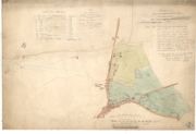
| Name: | Ainslie, John, 1745-1828 | |
| Title: | [Plan of the] Runriggs of Corshill / [by J. Ainslie] | |
| Imprint: | Drawn 1789. | |
| Zoom Into Map: | Click on the map to view in greater detail. | |
| Field | Content | |
|---|---|---|
| Name: | Ainslie, John, 1745-1828 | |
| Title: | Scotland, drawn from a series of angles and astronomical observations… | |
| Subtitle: | North-west sheet | |
| Imprint: | Edinburgh : J. & J. Ainslie & W Faden, 1789. | |
| Zoom Into Map: | Click on the map to view in greater detail. | |
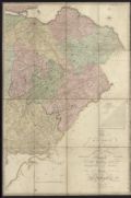
| Field | Content | |
|---|---|---|
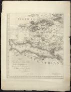
| Name: | Ainslie, John, 1745-1828 | |
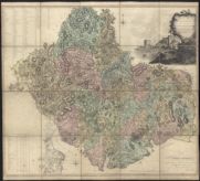
| Title: | Map of the County of Forfar or Shire of Angus. | |
| Subtitle: | North-west sheet | |
| Imprint: | Edinburgh : Ainslie, 1794. | |
| Zoom Into Map: | Click on the map to view in greater detail. | |
| Field | Content | |
|---|---|---|
| Name: | Ainslie, John, 1745-1828 | |
| Title: | Map of the County of Renfrew. | |
| Subtitle: | West sheet | |
| Imprint: | London : s.n., 1800. | |
| Zoom Into Map: | Click on the map to view in greater detail. | |
| Field | Content | |
|---|---|---|
| Name: | May, Peter (ca. 1724/35 - 1795); Ainslie, John (1745-1828) | |
| Title: | A Plan of the Barony of Castle Leod belonging to the Right Hon Lady Elibank reduced to a small scale from an old plan of P May by John Ainslie Land Surveyor Edinburgh | |
| Imprint: | Original survey 1750s, copied 1796 | |
| Zoom Into Map: | Click on the map to view in greater detail. | |
| Field | Content | |
|---|---|---|
| Name: | Ainslie, John, 1745-1828 | |
| Title: | The Stewartry of Kirkcudbright. | |
| Subtitle: | North-west sheet | |
| Imprint: | [Edinburgh] : s.n., 1797. | |
| Zoom Into Map: | Click on the map to view in greater detail. | |
| Field | Content | |
|---|---|---|
| Name: | Ainslie, John, 1745-1828 | |
| Title: | Stewartry of Kirkcudbright / by John Ainslie. | |
| Imprint: | [Edinburgh], 1797. | |
| Zoom Into Map: | Click on the map to view in greater detail. | |
| Field | Content | |
|---|---|---|
| Name: | Ainslie, John, 1745-1828 | |
| Title: | [North west] Stewartry of Kirkcudbright / by John Ainslie. | |
| Imprint: | [Edinburgh], 1797. | |
| Zoom Into Map: | Click on the map to view in greater detail. | |
| Field | Content | |
|---|---|---|
| Name: | Ainslie, John, 1745-1828 | |
| Title: | [North east] Stewartry of Kirkcudbright / by John Ainslie. | |
| Imprint: | [Edinburgh], 1797. | |
| Zoom Into Map: | Click on the map to view in greater detail. | |
| Field | Content | |
|---|---|---|
| Name: | Ainslie, John, 1745-1828 | |
| Title: | [South west] Stewartry of Kirkcudbright / by John Ainslie. | |
| Imprint: | [Edinburgh], 1797. | |
| Zoom Into Map: | Click on the map to view in greater detail. | |
| Field | Content | |
|---|---|---|
| Name: | Ainslie, John, 1745-1828 | |
| Title: | [South east] Stewartry of Kirkcudbright / by John Ainslie. | |
| Imprint: | [Edinburgh], 1797. | |
| Zoom Into Map: | Click on the map to view in greater detail. | |
| Field | Content | |
|---|---|---|
| Name: | Ainslie, John, 1745-1828 | |
| Title: | Scotland drawn and engrav'd from a series of angles and astronomical observations (South-west sheet only) | |
| Imprint: | Edinburgh : T Brown & W Faden 1800. | |
| Zoom Into Map: | Click on the map to view in greater detail. | |
| Field | Content | |
|---|---|---|
| Name: | Ainslie, John, 1745-1828 | |
| Title: | Map of the County of Renfrew by John Ainslie. | |
| Imprint: | London, 1800 | |
| Zoom Into Map: | Click on the map to view in greater detail. | |
| Field | Content | |
|---|---|---|
| Name: | Ainslie, John, 1745-1828 | |
| Title: | Scotland drawn and engrav'd from a series of angles and astronomical observations / by John Ainslie, land surveyor. | |
| Imprint: | Edinburgh : T Brown & W Faden, 1800. | |
| Zoom Into Map: | Click on the map to view in greater detail. | |
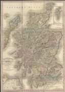
| Field | Content | |
|---|---|---|
| Name: | Ainslie, John, 1745-1828 | |
| Title: | Scotland / by John Ainslie. | |
| Imprint: | [Edinburgh] : Published according to act of parliament by Thomas Brown Edinburgh, [ca. 1800] | |
| Zoom Into Map: | Click on the map to view in greater detail. | |
| Field | Content | |
|---|---|---|
| Name: | Ainslie, John, 1745-1828 | |
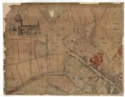
| Title: | Plan of Baron Norton's Feu at Norton Place. | |
| Imprint: | 1801. | |
| Zoom Into Map: | Click on the map to view in greater detail. | |
| Field | Content | |
|---|---|---|
| Name: | Ainslie, John, 1745-1828 | |
| Title: | [North west] The counties of Fife and Kinross with the rivers Forth and Tay / survey'd and engraved by John Ainslie ... | |
| Imprint: | London : W Faden, 1801. | |
| Zoom Into Map: | Click on the map to view in greater detail. | |
| Field | Content | |
|---|---|---|
| Name: | Ainslie, John, 1745-1828 | |
| Title: | [North centre] The counties of Fife and Kinross with the rivers Forth and Tay / survey'd and engraved by John Ainslie ... | |
| Imprint: | London : W Faden, 1801. | |
| Zoom Into Map: | Click on the map to view in greater detail. | |
| Field | Content | |
|---|---|---|
| Name: | Ainslie, John, 1745-1828 | |
| Title: | [North east] The counties of Fife and Kinross with the rivers Forth and Tay / survey'd and engraved by John Ainslie ... | |
| Imprint: | London : W Faden, 1801. | |
| Zoom Into Map: | Click on the map to view in greater detail. | |
| Field | Content | |
|---|---|---|
| Name: | Ainslie, John, 1745-1828 | |
| Title: | [South west] The counties of Fife and Kinross with the rivers Forth and Tay / survey'd and engraved by John Ainslie ... | |
| Imprint: | London : W Faden, 1801. | |
| Zoom Into Map: | Click on the map to view in greater detail. | |
| Field | Content | |
|---|---|---|
| Name: | Ainslie, John, 1745-1828 | |
| Title: | [South centre] The counties of Fife and Kinross with the rivers Forth and Tay / survey'd and engraved by John Ainslie ... | |
| Imprint: | London : W Faden, 1801. | |
| Zoom Into Map: | Click on the map to view in greater detail. | |
| Field | Content | |
|---|---|---|
| Name: | Ainslie, John, 1745-1828 | |
| Title: | [South east] The counties of Fife and Kinross with the rivers Forth and Tay / survey'd and engraved by John Ainslie ... | |
| Imprint: | London : W Faden, 1801. | |
| Zoom Into Map: | Click on the map to view in greater detail. | |
| Field | Content | |
|---|---|---|
| Name: | Ainslie, John, 1745-1828 | |
| Title: | To the ... Lord Provost, Magistrates and Council ... of Edinburgh this plan of ... Edinburgh and Leith ... is ... inscribed by ... John Ainslie ... / engraved by the surveyor & John Craig his assistant. | |
| Imprint: | [Edinburgh] : Sold by A Constable and W Faden Mrs Ainslie T Brown A Constable etc, 1804. | |
| Zoom Into Map: | Click on the map to view in greater detail. | |
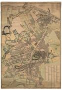
| Field | Content | |
|---|---|---|
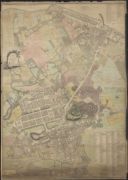
| Name: | Ainslie, John, 1745-1828 | |
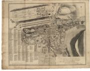
| Title: | Old and New Town of Edinburgh and Leith with the proposed docks. | |
| Imprint: | Edinburgh : The Author, 1804. | |
| Zoom Into Map: | Click on the map to view in greater detail. | |
| Field | Content | |
|---|---|---|
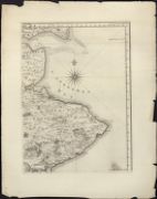
| Name: | Ainslie, John, 1745-1828 | |
| Title: | The environs of Edinburgh, Haddington, Dunse, Kelso, Jedburgh, Hawick, Selkirk, Peebles, Langholm and Annan, making a complete map of the South East district of Scotland / by John Ainslie. | |
| Imprint: | Edinburgh : Thos Brown, 1812. | |
| Zoom Into Map: | Click on the map to view in greater detail. | |
| Field | Content | |
|---|---|---|
| Name: | Ainslie, John, 1745-1828 | |
| Title: | Scotland with its islands / drawn from the topographical surveys of John Ainslie &c. | |
| Imprint: | London : W Faden, 1813. | |
| Zoom Into Map: | Click on the map to view in greater detail. | |
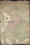
| Field | Content | |
|---|---|---|
| Name: | Ainslie, John, 1745-1828 | |
| Title: | Map of the environs of Glasgow, Paisley, Ayr, Lanark, Sanquhar, Wigton, Kirkcudbright &c. &c. &c. / by John Ainslie ... engraved by T. Clerk. | |
| Imprint: | [Edinburgh], 1820. | |
| Zoom Into Map: | Click on the map to view in greater detail. | |
| Field | Content | |
|---|---|---|
| Name: | Ainslie, John, 1745-1828 | |
| Title: | [North-west] Map of the environs of Glasgow, Paisley, Ayr, Lanark, Sanquhar, Wigton, Kirkcudbright &c. &c. &c. / by John Ainslie ... engraved by T. Clerk. | |
| Imprint: | Edinburgh : Macredie Skelly & Co, 1821. | |
| Zoom Into Map: | Click on the map to view in greater detail. | |
| Field | Content | |
|---|---|---|
| Name: | Ainslie, John, 1745-1828 | |
| Title: | [North-east] Map of the environs of Glasgow, Paisley, Ayr, Lanark, Sanquhar, Wigton, Kirkcudbright &c. &c. &c. / by John Ainslie ... engraved by T. Clerk. | |
| Imprint: | Edinburgh : Macredie Skelly & Co, 1821. | |
| Zoom Into Map: | Click on the map to view in greater detail. | |
| Field | Content | |
|---|---|---|
| Name: | Ainslie, John, 1745-1828 | |
| Title: | [South-west] Map of the environs of Glasgow, Paisley, Ayr, Lanark, Sanquhar, Wigton, Kirkcudbright &c. &c. &c. / by John Ainslie ... engraved by T. Clerk. | |
| Imprint: | Edinburgh : Macredie Skelly & Co, 1821. | |
| Zoom Into Map: | Click on the map to view in greater detail. | |
| Field | Content | |
|---|---|---|
| Name: | Ainslie, John, 1745-1828 | |
| Title: | [South-east] Map of the environs of Glasgow, Paisley, Ayr, Lanark, Sanquhar, Wigton, Kirkcudbright &c. &c. &c. / by John Ainslie ... engraved by T. Clerk. | |
| Imprint: | Edinburgh : Macredie Skelly & Co, 1821. | |
| Zoom Into Map: | Click on the map to view in greater detail. | |
| Field | Content | |
|---|---|---|
| Name: | Ainslie, John, 1745-1828 | |
| Title: | [North-west] The environs of Edinburgh, Haddington, Dunse, Kelso, Jedburgh, Hawick, Selkirk, Peebles, Langholm and Annan, making a complete map of the South East district of Scotland / by John Ainslie. Butterworth junt. script. | |
| Imprint: | Edinburgh : Macredie Skelly & Co, 1821. | |
| Zoom Into Map: | Click on the map to view in greater detail. | |
| Field | Content | |
|---|---|---|
| Name: | Ainslie, John, 1745-1828 | |
| Title: | [North-east] The environs of Edinburgh, Haddington, Dunse, Kelso, Jedburgh, Hawick, Selkirk, Peebles, Langholm and Annan, making a complete map of the South East district of Scotland / by John Ainslie. Butterworth junt. script. | |
| Imprint: | Edinburgh : Macredie Skelly & Co, 1821. | |
| Zoom Into Map: | Click on the map to view in greater detail. | |
| Field | Content | |
|---|---|---|
| Name: | Ainslie, John, 1745-1828 | |
| Title: | [South-west] The environs of Edinburgh, Haddington, Dunse, Kelso, Jedburgh, Hawick, Selkirk, Peebles, Langholm and Annan, making a complete map of the South East district of Scotland / by John Ainslie. Butterworth junt. script. | |
| Imprint: | Edinburgh : Macredie Skelly & Co, 1821. | |
| Zoom Into Map: | Click on the map to view in greater detail. | |
| Field | Content | |
|---|---|---|
| Name: | Ainslie, John, 1745-1828 | |
| Title: | [South-east] The environs of Edinburgh, Haddington, Dunse, Kelso, Jedburgh, Hawick, Selkirk, Peebles, Langholm and Annan, making a complete map of the South East district of Scotland / by John Ainslie. Butterworth junt. script. | |
| Imprint: | Edinburgh : Macredie Skelly & Co, 1821. | |
| Zoom Into Map: | Click on the map to view in greater detail. | |
| Field | Content | |
|---|---|---|
| Name: | Ainslie, John, 1745-1828 | |
| Title: | The environs of Edinburgh, Haddington, Dunse, Kelso, Jedburgh, Hawick, Selkirk, Peebles, Langholm and Annan, making a complete map of the South East district of Scotland / by John Ainslie. Butterworth junt. script. | |
| Imprint: | Edinburgh : Macredie Skelly & Co, 1821. | |
| Zoom Into Map: | Click on the map to view in greater detail. | |
| Field | Content | |
|---|---|---|
| Name: | Ainslie, John, 1745-1828 | |
| Title: | The environs of Edinburgh, Haddington, Dunse, Kelso, Jedburgh, Hawick, Selkirk, Peebles, Langholm and Annan, making a complete map of the South East district of Scotland / by John Ainslie. | |
| Imprint: | Edinburgh : J Johnstone W & AK Johnston &c, [post 1821] | |
| Zoom Into Map: | Click on the map to view in greater detail. | |
| Field | Content | |
|---|---|---|
| Name: | Ainslie, John, 1745-1828 | |
| Title: | Ainslie's Map of the Southern Part of Scotland. | |
| Subtitle: | West sheet | |
| Imprint: | Edinburgh : Macreadie Skelly & Co., 1821. | |
| Zoom Into Map: | Click on the map to view in greater detail. | |
| Field | Content | |
|---|---|---|
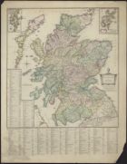
| Name: | Ainslie, John, 1745-1828 | |
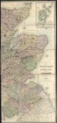
| Title: | Scotland ... / brought down to 1825 by John Ainslie. | |
| Imprint: | Edinburgh : D Lizars & J Gardner, 1825. | |
| Zoom Into Map: | Click on the map to view in greater detail. | |
| Field | Content | |
|---|---|---|
| Name: | Ainslie, John, 1745-1828 | |
| Title: | Scotland ... / by the late John Ainslie with the railways and other additions to 1840. | |
| Imprint: | Edinburgh : W & AK Johnston, 1840. | |
| Zoom Into Map: | Click on the map to view in greater detail. | |
| Field | Content | |
|---|---|---|
| Name: | Ainslie, John, 1745-1828 | |
| Title: | Scotland ... / by the late John Ainslie with the railways and other additions to the present time. | |
| Imprint: | Edinburgh : J Johnstone W & AK Johnston and Cowan & Co [ca. 1848] | |
| Zoom Into Map: | Click on the map to view in greater detail. | |
| Field | Content | |
|---|---|---|
| Name: | Ainslie, John, 1745-1828 | |
| Title: | Scotland ... / by ... John Ainslie with the railways and other additions to 1863. | |
| Imprint: | [Edinburgh : W & AK Johnston, 1863] | |
| Zoom Into Map: | Click on the map to view in greater detail. | |