Counties of Scotland
| Field | Content |
|---|---|
| Name: | Gall & Inglis |
| Title: | Gall & Inglis' map of the Clyde |
| Imprint: | Edinburgh, 1939. |
| Pagination: | 1 map : both sides ; 363 x 585 mm. |
| Shelfmark: | Map.s.121 |
| Zoom Into Map: | Click on the maps below to order image or view in greater detail. |
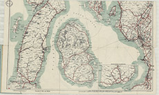
Top section
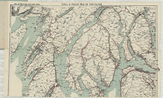
Bottom section