County maps, 1580s-1950s
| Field | Content |
|---|---|
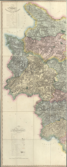
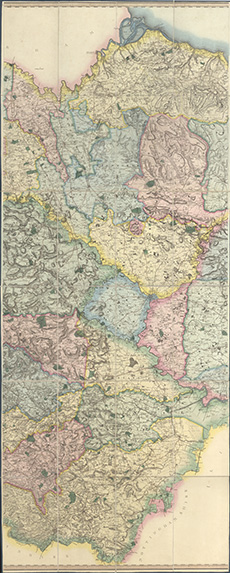
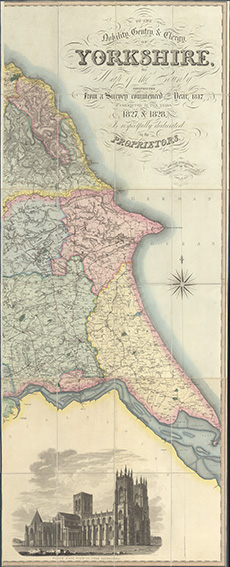
| Name: | Greenwood, C. (Christopher), 1786-1855 Teesdale, Henry Bingley, J. |
| Title: | To the nobility, gentry & clergy of Yorkshire, this map of the county constructed from a survey commenced in ... 1817, & corrected in the years 1827 & 1828, is ... dedicated by the proprietors |
| Imprint: | London : H. Teesdale & Co., & C. Stocking, 1828 |
| Pagination: | 1 map on 3 sheets ; sheets ca. 184 x 74 cm (ca. 72 x 29 inches) |
| Notes: | Scale: ca. 1 1/4 miles to an inch. View georeferenced map. |
| Shelfmark: | EME.b.2.29 |
| Zoom Into Map: | Click on the maps below to order image or view in greater detail. |
 |
 |
 |