Estate Maps, 1750s-1900s
| Name: | Ordnance Survey |
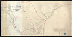
| Title: | Plan of lands to be disentailed in the Parish of Clyne. Plan No.1, 1895 (Annotated O.S. 6-inch map) |
| Imprint: | 1895 |
| Pagination: | 1 map ; 69 x 134 cm |
| Shelfmark: | Acc.10225/294 |
| Notes: | We are very grateful to Sutherland Estates for permission to display this map on our website. Sutherland Estate mapping home page. |
| Zoom Into Map: | Click on the map to view in greater detail. |