Estate Maps, 1750s-1900s
| Name: | W. & A.K. Johnston Limited |
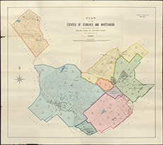
| Title: | Plan of the estates of Stirches and Whitehaugh as offered for sale : reduced from the Ordnance Survey and corrected to 1897 / lithographed by W. & A.K. Johnston. |
| Imprint: | Edinburgh : W & AK Johnston 1897. |
| Pagination: | 1 map on 2 sheets : col. ; 65 x 73 cm |
| Shelfmark: | EMS.s.790 |
| Zoom Into Map: | Click on the map to view in greater detail. |