Estate Maps, 1750s-1900s
| Name: | Keith and Gibb (lithographers) |
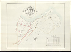
| Title: | Plan of part of the lands of Torry as now divided into lots, 1849 / Keith & Gibb, Draftsmen, Lithographers & Engravers. |
| Imprint: | [Aberdeen, 1849] |
| Pagination: | 1 map ; 476 x 612 mm |
| Shelfmark: | EMS.s.602 |
| Zoom Into Map: | Click on the map to view in greater detail. |