Estate Maps, 1750s-1900s
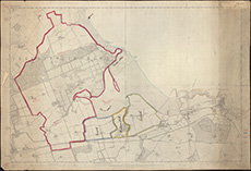
| Title: | [Marked 6-inch O.S. plan of part of East Lothian showing boundaries of the Estates of Tynninghame, Tynefield, Hedderwick Hill and Linkfield, the extent of the Salmon Fishings and proposed Road Metal Quarry] |
| Imprint: | Southampton, 1854. |
| Pagination: | 1 map ; 601 x 901 mm |
| Shelfmark: | EMS.s.401 |
| Zoom Into Map: | Click on the map to view in greater detail. |