Estate Maps, 1750s-1900s

| Name: | Gordon, David, 1820-1893 |
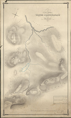
| Title: | Plan of the Hill Grounds of Wester Corriesulagach, part of Stratherrick, 1860 |
| Imprint: | 1860 |
| Pagination: | 1 manuscript map: col.; 96 x 58 cm. |
| Shelfmark: | Lovat366 |
| Notes: | 1:3813. (30 chains = 6" ). Unsigned, but is drawn in the style of David Gordon. Courtesy of Lovat Highland Estates and the North of Scotland Archaeological Society. View Lovat Highland Estates mapping |
| Zoom Into Map: | Click on the map to view in greater detail. |