Estate Maps, 1750s-1900s

| Name: | Gordon, David, 1820-1893 |
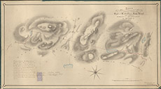
| Title: | Plan of the Western Portion of the Marches between the Properties of the Right Hon the Earl of Seafield and the Lord Lovat, being the whole Westward from Allt Caan a Keill as Settled in 1863 |
| Imprint: | 1864 |
| Pagination: | 1 manuscript map: col.; 55 x 98 cm. |
| Shelfmark: | Lovat337 |
| Notes: | 1:3960. (30 chains = 6" ). A settling of the marches between Seafield & Lovat. Handwritten at bottom leftof map: It is agreed between us, John Charles, Earl of Seafield and Thomas Alexander, Lord Lovat, that the Marches between our Properties delineated on the Plan shall be the Marches between the same in all time coming. In witness thereof....etc. Courtesy of Lovat Highland Estates and the North of Scotland Archaeological Society. View Lovat Highland Estates mapping |
| Zoom Into Map: | Click on the map to view in greater detail. |