Estate Maps, 1750s-1900s

| Name: | Gordon, David, 1820-1893 |
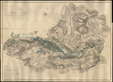
| Title: | Plan of the Estate of Struy situated in the Parish of Kilmorack, the property of the Right Hon Lord Lovat, 1853 |
| Imprint: | 1853 |
| Pagination: | 1 manuscript map: col.; 126 x 174 cm. |
| Shelfmark: | Lovat316 |
| Notes: | 1:7920. (8" = 1 mile ). A beautifully drawn and coloured map. Handwritten on the map: 10th October 1854 David Gordon surveyor - ie map completed a year after the survey. Courtesy of Lovat Highland Estates and the North of Scotland Archaeological Society. View Lovat Highland Estates mapping |
| Zoom Into Map: | Click on the map to view in greater detail. |