Estate Maps, 1750s-1900s
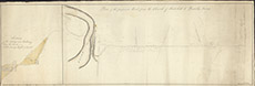

| Title: | Plan of the Proposed Road from the Church of Kirkhill to Beauly Ferry |
| Imprint: | 19th century |
| Pagination: | 1 map: col.; 86 x 30 cm. |
| Shelfmark: | Lovat251 |
| Notes: | Courtesy of Lovat Highland Estates and the North of Scotland Archaeological Society. View Lovat Highland Estates mapping |
| Zoom Into Map: | Click on the map to view in greater detail. |