Estate Maps, 1750s-1900s

| Name: | Gordon, David, 1820-1893 |
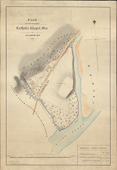
| Title: | Plan of the Proposed Catholic Chapel Feu at Glassburn, 1855 |
| Imprint: | 1855 |
| Pagination: | 1 map: col.; 52 x 35 cm. |
| Shelfmark: | Lovat218 |
| Notes: | In Strathglass Scale 1:1218. (10 chains = 6.5" ). Courtesy of Lovat Highland Estates and the North of Scotland Archaeological Society. View Lovat Highland Estates mapping |
| Zoom Into Map: | Click on the map to view in greater detail. |