Estate Maps, 1750s-1900s
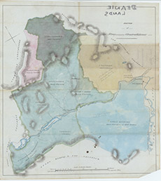

| Title: | Sketch of Struy and part of Glenstrathfarrar |
| Imprint: | 1830s ? |
| Pagination: | 1 map: col.; 44 x 40 cm. |
| Shelfmark: | Lovat202 |
| Notes: | Shows large part of the east of Glenstrathfarrar plus Struy, with various estates in different colours. As far west as Loch Moyley. Scale 1:31680. (200 chains = 5" ). Courtesy of Lovat Highland Estates and the North of Scotland Archaeological Society. View Lovat Highland Estates mapping |
| Zoom Into Map: | Click on the map to view in greater detail. |