Estate Maps, 1750s-1900s
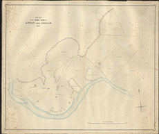

| Title: | Plan of the Arable Lands of Annat and Groam |
| Imprint: | 1857 |
| Pagination: | 1 map: col.; 80 x 96 cm. |
| Shelfmark: | Lovat199 |
| Notes: | Although un-signed, in the style of David Gordon, surveyor Scale 1:2400. (25 chains = 8.25" ). Courtesy of Lovat Highland Estates and the North of Scotland Archaeological Society. View Lovat Highland Estates mapping |
| Zoom Into Map: | Click on the map to view in greater detail. |