Estate Maps, 1750s-1900s
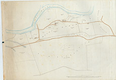

| Title: | [Mains of Eskedale] |
| Imprint: | 1920s ? |
| Pagination: | 1 map: col.; 58 x 82 cm. |
| Shelfmark: | Lovat182 |
| Notes: | Plan showing Mains of Eskedale and surrounging land. Now known as Eskadale House Scale 1:2376. (15 chains = 5" ). Courtesy of Lovat Highland Estates and the North of Scotland Archaeological Society. View Lovat Highland Estates mapping |
| Zoom Into Map: | Click on the map to view in greater detail. |